


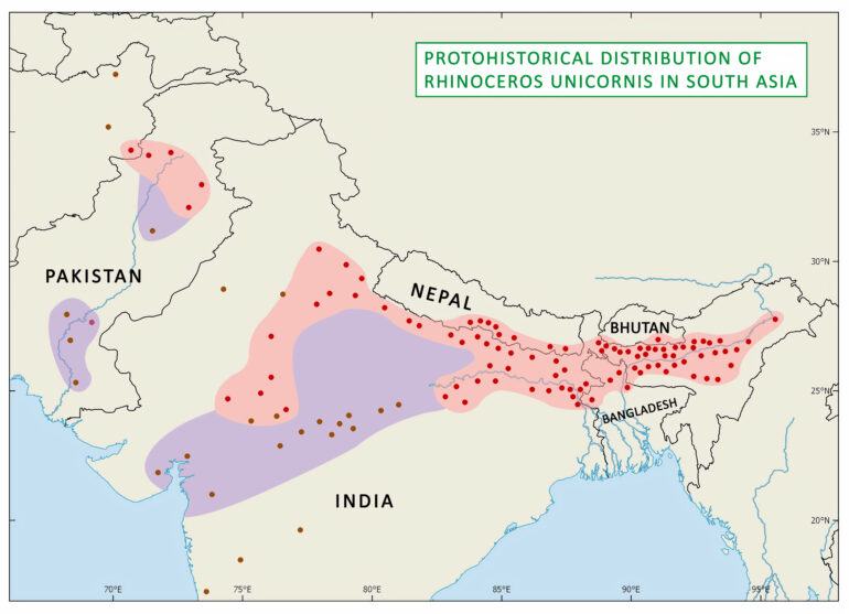
Map showing the Protohistorical distribution of Rhinoceros unicornis. The three regions in purple represent the known records of the early period from the start of the Holocene (11,700 years before present). The two regions in light red represent historical records from 1500 CE, as in the map of the Historical distribution of the species. The records exclude any fossil occurrences of the Pleistocene and before.
Map published in Rookmaaker, L.C., 2024. The rhinoceros of South Asia. Leiden, Brill, p. 715, map. 65.35. https://doi.org/10.1163/9789004691544_066.
© L.C. Rookmaaker. Map design by Ajay Karthick and Richard Kees. – Chapter is published as Open access under the terms of CC BY-NC-ND 4.0 license.